

My BRB Mortgage › Blue Ridge foothills
The Blue Ridge foothills
The Blue Ridge is the eastern rampart of the southern Appalachians, running from Pennsylvania to northern Georgia. Where it meets the rolling Piedmont there is a band of foothill country in which the landform, more than any plan, decided where people built.
The landform
The escarpment is abrupt on its eastern side. Rivers coming off the mountains drop quickly, then slow as they cross the Piedmont, and the line where they change character — the fall line, much further east — marks the head of navigation. Between the two lies the foothill country: ridges and coves, narrow bottoms, shallow soils on the slopes and better soils in the valley floors.
That geometry dictates almost everything about settlement. Level, well-drained, buildable land is scarce and occurs in strips. Roads follow valleys and gaps because crossing a ridge costs money. Water is abundant but arrives in fast, steep streams rather than slow rivers.
How the land was divided
Upland parcels in this region were laid out to follow the ground rather than a grid. Boundaries ran along watercourses, ridgelines and marked trees, producing irregular holdings of very different sizes and shapes. The consequences are still visible in the record: parcels whose lines make no sense on a map until the contours are drawn behind them.
Because a farm needed bottom land for crops and slope for timber and pasture, holdings were assembled across the gradient rather than within one band of it. Later subdivision cut across that logic, which is why so many foothill lots contain a small usable shelf and a large quantity of steep ground.
Water, mills and the first villages
Fast water was the region's first industrial resource. A stream with a reliable fall could turn a wheel for grinding grain or sawing timber, and a mill drew a store, a smithy, a church and a cluster of houses. Many small foothill communities are the descendants of a mill seat rather than of a plan.
When steam and then electricity removed the need to sit beside moving water, the logic of location shifted to the roads and rail. Some mill hamlets faded into a crossroads with a name; others were captured by a new highway and grew.
What gets built on a slope
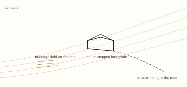
Housing in this country is shaped by drainage and access before anything else. Foundations step down the grade; basements are cut into the hill on the uphill side and open at grade on the downhill side; porches face the view rather than the road because the view is what the site has.
Driveways are a real constraint. Length, gradient and turning space determine whether a parcel is practical in winter, and a long steep drive is a maintenance liability of its own. Septic capacity and well depth do similar work: on unsewered land the buildable area is set by where a drainage field can go, not by the size of the lot.
Reading a foothill parcel
The useful questions are geographic. Where does water go when it rains hard; how much of the parcel is under a slope steep enough to restrict building; where is the nearest public road and who maintains the route to it; is the property served by mains water and sewer or by well and septic; and what does the treeline do to sun in December.
None of these are exotic. They are simply the questions that flat serviced suburban land answers automatically and this land does not.